Study examines pedestrian safety on Watkins Drive
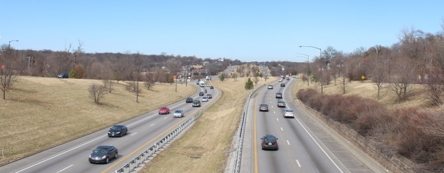
Crossing Bruce R. Watkins Drive can intimidate any pedestrian or cyclist.
There are limited places to cross safely. Parts of the roadway are 80-feet wide with five lanes of traffic. The speed limit may be set at 45 mph in areas, but cars regularly zip along much faster.
The KCATA recognizes these issues, especially with plans for putting the city’s third bus rapid transit route on Prospect Avenue just west of Bruce Watkins Drive, also known as U.S. 71.
It’s why the authority is leading a study of how it can improve pedestrian and cyclist access to bus service on Prospect Avenue from neighborhoods on the east side of Bruce Watkins Drive.
“Bruce Watkins Drive is an important highway for commuters travelling from south Kansas City to downtown, but is also a major barrier for the neighborhoods it runs through,” said KCATA Planner Shawn Strate.
“Pedestrian safety has been a longstanding issue, as people often risk crossing the highway between signalized intersections," Strate said." It’s important that residents, employees, and visitors are able to cross the highway safely to access jobs, goods and services.”
Joining the KCATA in the study are the Missouri Department of Transportation, the city of Kansas City and the Mid-America Regional Council.
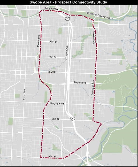
Here's the area under study for improved pedestrian access on U.S. 71.
The study will focus on an area of Watkins Drive between 85th Street and Swope Parkway south of Brush Creek, bounded by The Paseo on the west and Cleveland Avenue in the east.
The goal is to craft solutions for creating a safe environment for pedestrians and bicyclists crossing Watkins Drive to reach Prospect Avenue and the new MAX service that should start there by early 2019.
Ultimately, we want to encourage residents to use the community amenities that are available to them on Prospect, including transit, jobs, health care, community centers and schools.
A mix of high traffic speeds, limited crossings and a broad roadway potentially hinder anyone trying to reach Prospect, which is one of the most heavily used transit corridors in the region.
Signalized crossings are about a quarter mile apart and bridges are about a half-mile apart, making it hard for pedestrians and bicyclists to safely cross the busy highway.
There are already signs of worn paths in the medians indicating that pedestrians are crossing where it’s most convenient and not necessarily where it’s safest at a bridge or an intersection.
The study is now getting into full swing and is expected to be completed by the end of 2017.